 |
Brookline / Llanerch |
The interactive map below shows the present extent of the Pennsy Trail through the heart of Haverford Township. The segment north of Manoa Road runs through Brookline up to Oakmont, while the segment south of Manoa Road is in Llanerch. Trailhead access points and parking locations are shown. (Do not park in the Haverford Area Y parking lot.) The trail's map color is the Pennsylvania Railroad's signature "Tuscan Red."
Click or tap on the "four corners" icon (upper right) to open a larger full-screen map.
Click or tap on the small box icon (upper left) to open a list of trails.
Click or tap on a trail or its listing to see its details, length and maybe a photo.
The longer Brookline section of the Pennsy Trail leads from Manoa Road and Columbia Road and runs all the way north to the rear of the Haverford Area Y parking lot. It also connects to the bottom of Veterans Field, the paved Princeton Road - Lincoln Avenue path, Harvard Road and Ralston Avenue.
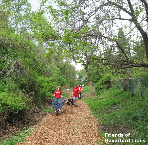
It was originally cleared and a woodchip surface was added during 2013 and 2014, through the efforts of many organizations and hundreds of volunteers, in time for the grand opening of the "Y." During 2015-2016 Haverford Township, using grant funding, transformed the woodchip trail into a wider, accessible and bikeable macadam trail, which has become very popular.
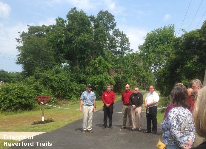
The southern, shorter Llanerch section of the Pennsy Trail starts at Vernon Road off West Chester Pike, runs behind the Llanerch Shopping Center and heads north to Manoa Road. This section was re-cleared and given a woodchip surface by the Llanerch Civic Association and the Friends of Haverford Trails. In 2024 this section was paved, when a new trail bridge over Manoa Road was installed to connect it. It provides the isolated section of Llanerch between the trail and Darby Road with improved, safer access to the township building, Skatium, library, middle and high schools, and other attractions.
